Chrismar Woodland Caribou Map
$16.95
Waterproof map of Woodland Caribou Park and Area.
4 in stock
Description
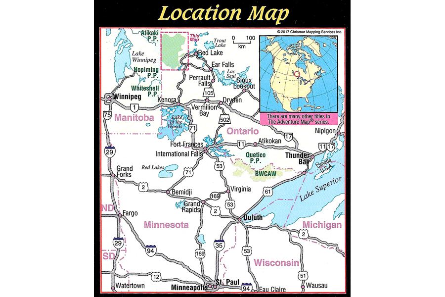
Looking for a huge expanse of world-class wilderness paddling territory? Then Woodland Caribou Provincial Park in northwestern Ontario is the place to go. The Park is located on the Ontario side of the provincial border with Manitoba, is one of the world’s finest paddling destinations. And yet it is not at all heavily used.
This comprehensive guide highlights over 4,000 square kilometres of scenic lakes, rushing and meandering streams, roaring rapids and waterfalls, punctuated by open wetlands and rocky outcrops. It’s unlike most other Ontario Parks in that access is only possible by flying or paddling in. There are several access points with parking lots on the Park boundary, but no roads in the Park, so you can be guaranteed the greatest seclusion possible in today’s world.
Perhaps you’ve heard of the Bloodvein River, one of Canada’s more southern long-distance whitewater paddling routes – it begins on and crosses this map, before continuing off the map to the west on its way to Lake Winnipeg. But there are other whitewater opportunities within the Park too.
Despite that seclusion there a few outfitters, lodges and other services around the Park to assist your access to this wilderness, and park management works hard to keep campsites, portages and about 2,000 kilometres of paddling routes in good order.
Wilderness paddlers, whether experienced or novice will appreciate the superb network of beautiful lakes and rivers connected by short portages (average ~300 metres!) that bypass occasional rapids and a large number of waterfalls. Ideal paddling terrain. And the goal here IS wilderness paddling. Period! And that’s something you can’t say about any other park in North America, except perhaps Quetico Provincial Park further south (we also have a map guide to that area).
At 1:110,000 scale this map has extraordinary geographic detail plus access points, portages, island names, lake elevations, route helpers and many other helpful features. It also covers areas outside the Park including the nearby Town of Red Lake and the huge body for which it was named.
Text and colour photos cover the entire backside of this 91x66cm (26×36 inch) waterproof guide (folded to 4×9 inches). You’ll find information about the natural history of the area, fishing (which is fabulous!), backcountry procedures & etiquette, sample routes, detailed inset maps highlighting different areas, safety tips, contact information and much more. There is even a reference system to the major lakes – we’ve surveyed over 5,200 for this map – as well as 392 portages, 34 falls, and over 7,840 islands!
Like all Adventure Map® guides this one is completely original, which is why it took Chrismar 2 years to create! It covers the area of numerous government topos and has considerably more detail. Produced in cooperation with and carefully reviewed by Woodland Caribou Provincial Park staff, who have adopted it as the preferred map of the area. On waterproof plastic as usual.
Additional information
| Weight | .9 kg |
|---|---|
| Dimensions | 23 × 11 × .5 cm |
