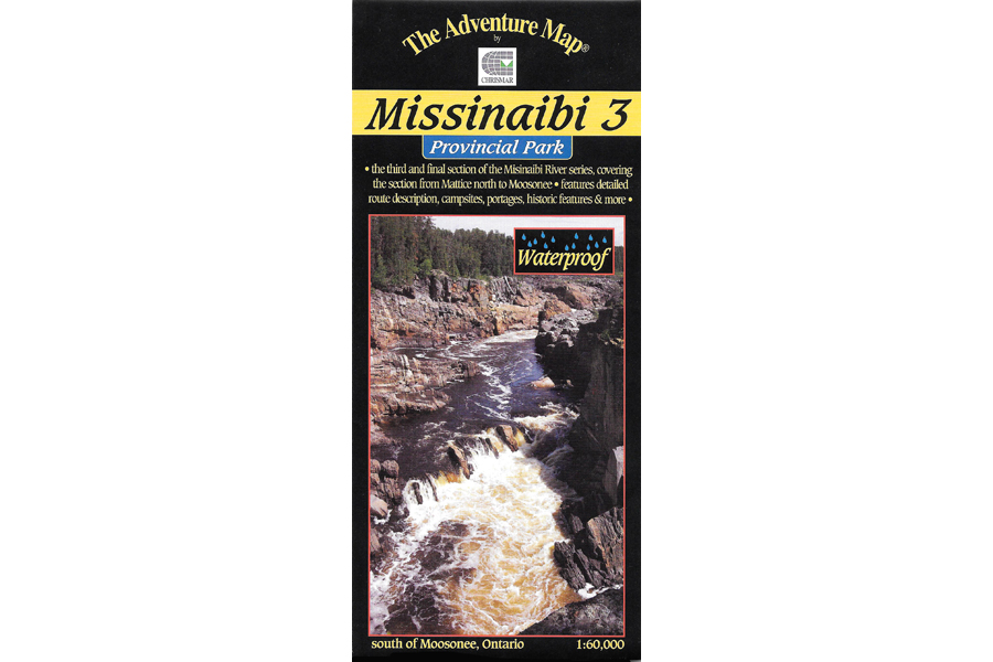

Chrismar Maps Missinaibi 3
$16.95
Most serious paddlers have heard of the Missinaibi River – the longest unbroken stretch of paddling river in Ontario.
4 in stock
Description
This 3rd guide in our Missinabi series covers the route from the Town of Mattice all the way downstream or northward to Moosonee near James Bay, a distance of 314 water kilometres.
The first part of the route has an abundance of challenging whitewater rapids, and while there are portages to get you around the ones you don’t wish run, there are plenty that will give you a great ride.
One big feature of this section of the route is the big drop-off at the Thunderhouse Falls area from the Precambrian Shield onto the Hudson Bay Lowlands. After the maelstrom of falls, chutes, rapids and canyons the river turns sharply, slows and broadens on its unimpeded run to Moosonee, and just beyond it, James Bay.
Access to this area can be a challenge, so we spend some time providing information about the various options (car, train, plane, outfitters, shuttles, etc.), in addition to a comprehensive route description and other features to help you plan and take your trip.
This guide also discusses and shows in some detail, how the fur trade defined much of the early exploratory history of Canada. You can still visit the site of Hudson Bay Company’s posts, and the places where its arch-rival Northwest Company battled, sometimes literally, for fur-trading supremecy in the New World.
This waterproof, 1:60,000 scale, completely original (like all our others) topographic map has extraordinary detail, and includes text and photos about natural and human history, canoe route descriptions, safety tips, contact info, great colour photographs – in short just about everything you’d want to help you plan and enjoy your trip.
Additional information
| Weight | 1 kg |
|---|---|
| Dimensions | 23 × 11 × 0.5 cm |